Càrn na Caim and A’Bhuidheanach Bheag, Drumochter
To the east of the Pass of Drumochter, a high plateau contains the two Munros, Càrn na Caim and A’Bhuidheanach Bheag.
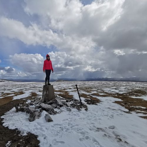
Càrn na Caim is furthest north; the usual ascent takes you along faint paths but a line of fence posts will help you keep your bearings. You cross boggy ground as you approach the summit but the views you’ll find there are worth the walk.
A’Bhuidheanach Bheag’s tongue-twisting title translates from Gaelic as “Little Yellow Place”, most likely a nod to the yellow grass covering the land. The rolling terrain here heightens your sense of perspective – endless skies above wide open space.
On the hillside, varied wildlife abounds including dotterel, ptarmigan, grouse and mountain hares.
The open expanses of this region make navigation tricky if visibility is reduced in poor weather. Ignore the sniffs of technophiles and bring those old-fashioned stalwarts: map and compass.
Nearest town: Dalwhinnie
Distance: 19km / 11.75 miles
Time 5-6: hours
Ascent: 824m
Starting point: A9 layby, 0.75km south of Dalwhinnie junction
Photo credit: Rachie Wojx